- Parking available
- Free admission
Einsiedelei Hiking Parking Lot
Parking | Nature Sign/Information Center | Nature Reserve/Natural Landmark
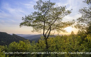
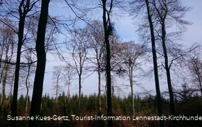
The Einsiedelei Hiking Parking Lot is an excellent starting point for hikes through the beautiful beech and swamp forests of the FFH site “Beech and Swamp Forests near Einsiedelei and Apollmicke.”


Address
Einsiedelei Hiking Parking Lot
zwischen Oberveischede und Benolpe
57368 Lennestadt
Properties:
The hiking parking lot is located between Federal Highways B 55 and B 517, near the small, idyllically situated villages of Einsiedelei and Apollmicke.
Beech Forests at Einsiedelei
The Einsiedelei Nature Reserve encompasses one of the largest contiguous beech forest complexes in the central and western Sauerland. Particularly valuable features of the area are the beech forests—some up to 190 years old—the natural spring basins, and the small streams with their alder forests lining the marshes and stream banks. The old-growth beech forests, rich in hollows, are home to breeding populations of Tengmalm’s owl, black woodpecker, and gray woodpecker. The area’s greatest botanical treasure is the lesser twayblade, an orchid endangered throughout Germany, which has its only location in North Rhine-Westphalia here.
Circular Hike Recommendation: Nature Discovery Trail: The 5.6 km Nature Discovery Trail leads through the area’s unique features.
Long-Distance Hiking Tip: Veischeder Sonnenpfad: The Einsiedelei hiking parking lot is also the starting and ending point of the approximately 37 km long loop trail “Veischeder Sonnenpfad.” Those who wish can complete this hike in a single day to enjoy the nature and cultural and historical sights (e.g., Bilstein Castle) along the way; however, hiking it in stages is also a good option. Since 2013, the “Veischeder Sonnenpfad” has held the “Qualitätsweg Wanderbares Deutschland” seal of quality.
__________________________________
Coordinates for the navigation system (WGS 84):
GPS: N 51° 3' 55.9008 E 7° 59' 1.8384
UTM: 32U 428798.004 5657603.052
__________________________________
The facility belongs to the Sauerland Rothaargebirge Nature Park Association (Naturpark Sauerland Rothaargebirge e.V.) and is maintained and cared for by the association.
However, if you notice any litter or damage, please notify us by email at info@npsr.de.
(Source: Naturpark Sauerland Rothaargebirge e.V.)
Directions
On the B55 coming from Kirchveischede, just before the Oberveischede neighborhood, follow the signs on the left and turn