- Culturally interesting
- Refreshment stop
- Circular route
Rothaarsteig theme trail - Meiler, Wallen, Wüstungen
Tour starting point:
Brilon marketplace
Tour destination point:
Brilon marketplace
Properties:
Additional Information
www.tourismus-brilon-olsberg.deCategory
ThemenwegLength
18.6 kmDuration
5:20 hElevation ascent
352 mElevation descent
345 mLowest point
427 mHighest point
617 mCondition
Difficulty
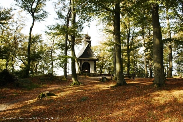
Do you actually know field terraces, trace bundles or pile slabs and would you recognize them? Many such traces, also known as historical cultural landscape elements, can still be discovered along the Rothaarsteig. They tell us about how previous generations dealt with nature and the landscape and provide an insight into former social conditions and technologies. Together with the natural structures of the landscape, they contribute significantly to the special character and uniqueness of a landscape and provide a habitat for many endangered animals and plants. We invite you on a journey in the footsteps of our ancestors from times long past. The churchyard lies in the middle of a former medieval rampart, which has a triangular basic shape. One of the three castle gates has been reconstructed. The oldest ramparts probably date back to the time around the birth of Christ, when Germanic tribes defended themselves against the Celts advancing from the north. Excavations on the Borberg also uncovered the foundation wall of a church from the 13th/14th century. Today, the Borberg Chapel, which was built in 1925 in honor of Mary, Queen of Peace, is located at the highest point of the square.
Information
Directions
Route: - Market square (459 m) - Ammertenbühl (473 m) - Poppenberg (580 m) - Petersborn (540 m) - Hiebammenhütte (513 m) - Borberg's Kirchhof (606 m) - St. Antonius (615 m) - Schustersknapp (595 m) - Petersborn (540 m) Sights: Altstadt Brilon, Borberg's KirchhofRefreshment stops: Hiebammenhütte, restaurants in Brilon
Equipment
Safety guidelines
Author Tip
Literature
Maps
Public transit
Take the bus to the Brilon-Markt stop.
How to get there
A1 to Dortmund/Unna junction - then A44 to Werl junction - then
A445/A46 to Bestwig-Velmede junction and continue on the B7 to Brilon
from the north:
Hannover - A2 to Bielefeld junction - A33 to Wünnenberg-Haaren junction
and continue on the B480 to Brilon
from the east:
A44 Kassel to Wünnenberg-Haaren junction and continue on the B480 to Brilon or exit at Marsberg junction and continue on the B7 to Brilon
from the south:
to Kassel and continue on the A44 to Wünnenberg-Haaren junction or exit at Marsberg junction and continue on the B7 to Brilon
