- Refreshment stop
- Multi-day tour
- Accommodation option
- Circular route
- Signage
- Tour with dog
The Lenne Trail - 80 km hiking experience in the Sauerland Rothaargebirge Nature Park
Tour starting point:
Altenhundem
Tour destination point:
Altenhundem
Properties:
Category
regionaler WanderwegLength
81.5 kmDuration
25:03 hElevation ascent
2256 mElevation descent
2153 mLowest point
244 mHighest point
695 mCondition
Difficulty
Length: 80 km
Marking: L
Altitude: 240 - 700 m above sea level
Difficulty: medium
Daily stages: 4 stage locations: Altenhundem, Milchenbach/Saalhausen, Oedingen, Bonzel
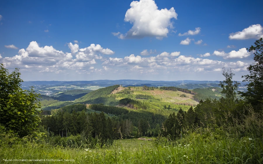
Old Wallen/castle complexes and churches and chapels worth seeing invite you to visit along the way. The L - Trail is a low mountain hike at altitudes between 239 m (Borghausen) and 700 m (Margaretenstein) above sea level. The total length of the trail is 81 km. It is marked with an L in a white circle. The route is perfectly marked. The route is easy to complete, even for inexperienced hikers.
Including access and exit points to the individual stages along the Lenne Trail (Altenhundem, Milchenbach, Oedingen, Bonzel), the total hiking distance is 87 km.
Our tip: We recommend wearing lightweight hiking boots as well as clothing suitable for hiking. There are several hiking parking lots directly on the circular hiking trail, offering you the opportunity to plan your own route. We recommend using the 1:25,000 scale Lennestadt-Kirchhundem hiking map as a basis for planning the hiking tour and for orientation on site, which is available from the tourist information offices in Altenhundem, Oberhundem and Saalhausen as well as from bookshops.
Information
Directions
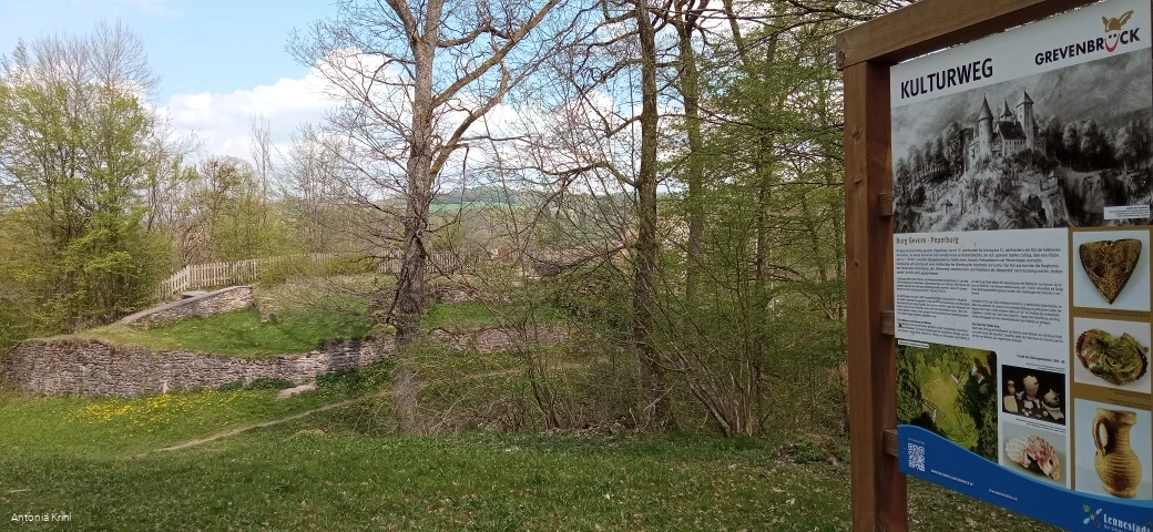
"Kirchberg Route" (approx. 22 km; Altenhundem - Milchenbach)The first stage follows the "Kirchberg Route" from the tourist information office at Lennestadt-Altenhundem train station. Via Pfarrgasse, Piepersweg, Zur Töte and Neuer Waldweg, you reach Kirchberg after around 4 km. 1.5 km further on you come to the "Steinernen Kreuz", later to Potsdamer Platz. From there, it is worth making a detour to the Alpenhaus (approx. 10 min.) - here you can stock up on chilled drinks from the fridge/no catering service at the moment. Via Heiligenborn, you reach the Bömenkamp refuge approx. 7 km further south, passing the Rothaarsteig experience station "Flurbereinigung". Just under 1 km further on, at Margarethenstein (700 m above sea level), you meet the premium hiking trail "Rothaarsteig". At Margaretenstein, we leave the Rothaar ridge and after approx. 8 km reach the day's destination, the two-time federal gold medal village of Milchenbach"Hülsberg Route" (approx. 18 km; Milchenbach - Oedingen)*The second stage, the Hülsberg Route, first leads from Milchenbach down to Störmecke in the Lennetal valley, which gave Lennestadt its name. After crossing the Lenne (334 m above sea level) in Störmecke, the ascent to the 660-metre-high Greitemannstein awaits. Passing the Auergang, you reach the Hülsberg (661 m). The L - trail continues to Wehrscheid, from where a detour to the Christine Koch hut (approx. 200 m) is worthwhile. The route continues past the village of Bracht, which already belongs to the Hochsauerland district, through the Elsmecke valley, following the hiking sign from Oedingerberg to today's stage destination, the village of Oedingen in the Elspetal valley, which is over 1000 years old."Hirtenberg-Route" (approx. 26 km; Oedingen - Bonzel)*The Hirtenberg-Route leads with the  hiking sign from Oedingen, past the remains of the monastery built in the ramparts of a castle from Carolingian and Ottonian times. It lies in the triangle of 3 important roads of the Middle Ages, which could be controlled from there. After reaching the altitude (470 m above sea level) at Schwartmecke, a former transformer station (now an inn), we hike westwards without any major ascents. Continue via Obervalbert, past Hirtenberg (497 m above sea level) and Elsmecke to reach the Primenekes Kopf refuge after approx. 6 km. Continue downhill past Raizebeil (435 m above sea level) and Mondschein to Sporke. Don't be surprised if you hear Indian howls and gunshots on the left. This is because we have passed the Elspe Festival with the annual Karl May Festival. South of Sporke, we cross the Lenne again in Borghausen. The route continues above the Lenne in an easterly direction to Grevenbrück. There we come across the ruins of Peperburg Castle, from where the former lords of the castle were able to guard the confluence of the Veischede and Lenne rivers. From the "Linde" hiking point, follow the hiking sign past Grevenbrück (church and town museum well worth seeing) through the Veischede valley to today's stage destination, the 725-year-old village of Bonzel."Kreggenberg-Route" (approx. 24 km; Bonzel - Altenhundem)*From Bonzel, we first follow the hiking sign back onto the L-path for approx. 8 km in a south-westerly direction to/after Jäckelchen. We cross the large, contiguous forest area between Repe and Veischedetal. From Jäckelchen, the trail descends into the Veischede valley through Bruchhausen (via the B55) to Schmellenberg on the opposite side of the valley. The L-path continues past the Apollmicke hiking parking lot, the hermitage with a refuge and the Kreggenberg to the Benolpe cross with a refuge. Here, by the way, we hike on the "Hiking Trail of German Unity". The route continues for approx. 4 km, past the Buscheid (599 m above sea level) to the Hohe Bracht with a restaurant and a viewing tower (581 m above sea level), the landmark of the Olpe district. The route then descends into the Hundem valley, crosses the Hundem and then the railroad line and the B 517. We return to the starting point of the Lennestadt circular route on familiar roads (Unterm Beul, An der Steinkuhle, Neuer Waldweg, Zur Töte, Piepersweg, Pfarrgasse) and reach Altenhundem again.
Equipment
Safety guidelines
Most hiking trails run away from towns and settlements and every hiker has thought about what would happen if an emergency were to occur. How can I be found here? Where am I anyway? Can the emergency services reach me?
But in an emergency, things have to move quickly! That's why the hiking trail network in the Lennestadt & Kirchhundem region is equipped with so-called rescue signs throughout. The green and white stickers attached to the posts of the signposts have a number that you must give when making an emergency call. This allows the emergency services to recognize the location directly and valuable time can be saved.
Author Tip
Maps
Tourist-Information Lennestadt & Kirchhundem
Hundemstr. 18, 57368 Lennestadt
www.lennestadt-kirchhundem.de
